Pinned Items
Recent Activities
-
BEAUTIFUL LANDSCAPES – MOUNT GULAGA
AUSTRALIA'S COASTAL WILDERNESS
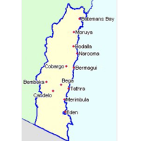
Australia’s Coastal Wilderness extends from Montague Island off Narooma in NSW to Lakes Entrance in Victoria. It features one of the largest tracts of intact temperate forest coastal wilderness in the world. Over 90% of these coastal forests are protected in perpetuity as national parks. This provides rare geotourism opportunities for visitors to experience the beauty, solitude and grandeur of remote untouched beaches and rugged coastal scenery.
According to Bruce Leaver, a key architect of the former ‘Australia’s National Landscape Program’, the area has a fascinating earth history. The backdrop to the region is the steep coastal hinterland escarpment of the Great Dividing Range, cutting into the elevated inland Cretaceous plain. The escarpment retreated from its coastal origins marking the back-arc rifting that created today’s east coast of Australia and the Tasman Sea from 90 to 50 million years ago.
The rugged mountains and ranges on the coastal side of the escarpment are residual erosion features that remained after the heavy stream and river erosion during the Paleogene when the region was some 3000 km to the south.
One of the most prominent mountains is Gulaga, as named as Mount Dromedary by Captain Cook in 1770. The current name is increasingly used, reflecting the outstanding cultural significance of the mountain to the Yuin people. Today it is a national park, co-managed with the traditional owners.
Gulaga is a large intrusion, part of a volcanic complex that includes Montague Island. The complex is part of the huge mid-Cretaceous Whitsunday Siliceous Large Igneous Province that heralded break up and the formation of the Tasman Sea.
The older earth history of the region is part of the Silurian - Devonian elements of the Lachlan Fold Belt. Granites of the Bega Batholith dominate much of the landscape, intruded into the Ordovician turbidites that previously covered the region. These turbidites can be readily seen on many coastal headlands and the forested ridges overlooking areas of younger granite, being more resistant to erosion.
As the Lachlan Orogen waned, a late Devonian back-arc rift dissected the landscape. The Eden-Comerong-Yalwal Rift extends from under the Sydney Basin to Gabo Island in Victoria. The rift includes volcanics, granite, and sedimentary sequences. It is particularly interesting as it displays a range of typically Devonian features - the Merimbula Red Beds, a tetrapod walkway in the Genoa River, ancient shark fossils and fossils of early forests.Post is under moderationStream item published successfully. Item will now be visible on your stream. -
 Post is under moderationStream item published successfully. Item will now be visible on your stream.
There are no activities here yet